Archive for the ‘Kelowna bike map’ Category

These are a few of my favourite things

March 10, 2009

Son of a gun it was cold last night. Biking east-west was like biking up hill both ways. Sometime in the future remember it was -20 in the second week of March.

Part of my regular route these days is Burtch Ave, Guisachan Rd, Stillingfleet, Cameron and Morrison. There is a wonderful pedestrian crossing at Gordon and Cameron that could use a bicycle friendly light activation switch. I am going to ask the city for one.

Do you have a favourite route you would like others to know about? Write us and we will post it on the web and share it with others riders. Who know maybe the city will make it even safer.
starting-the-hike

City of Kelowna – offroad bicycle plan – 2004

January 15, 2008

I very recently discovered that in 2004 a study was completed by Urban Systems, a local engineering firm. The study was commissioned by the City of Kelowna. You can find three documents, the 103 page study and two associated maps in .pdf.  They are at the bottom of the page and are available for download:

http://www.kelowna.ca/CM/Page420.aspx

The results of this study have not been made part of the official community plan so it sits in “limbo” right now. I will comment further on the study and suggested routes as time permits. It is however interesting viewing and reading.

John.

Kelowna’s bike route map on-line!

June 13, 2007

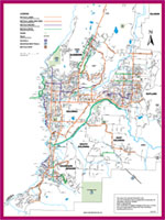
On the i-go.ca website you can find “active living” resources like Bike to Work week, bus routes and of course the bike route map. I think this is the first version. You can pick up the second printing at select bike shops and 4th floor at city hall. The link is http://www.kelowna.ca/CM/Page903.aspx. Feel free to use this map to offer you suggestions on future bike routes or correcting current ones.

Kelowna bike route map  bicycleroutemap.gif